The Siltation Committee oversees construction and monitors erosion at Raintree. Soil that enters the lake due to run-off and erosion collects on the bottom of the lake as silt. Minimizing this erosion helps to maintain a clean lake community. The Committee addresses existing problem sites where excess silt has accumulated, examines possible solutions, and makes recommendations to the RLPOA Board of Directors. You can email the Siltation Committee at mailto:siltation@rlpoa.com
Raintree Lake and Waterscape Topology
Double click on the picture in order to zoom into a particular area you are interested in looking at.
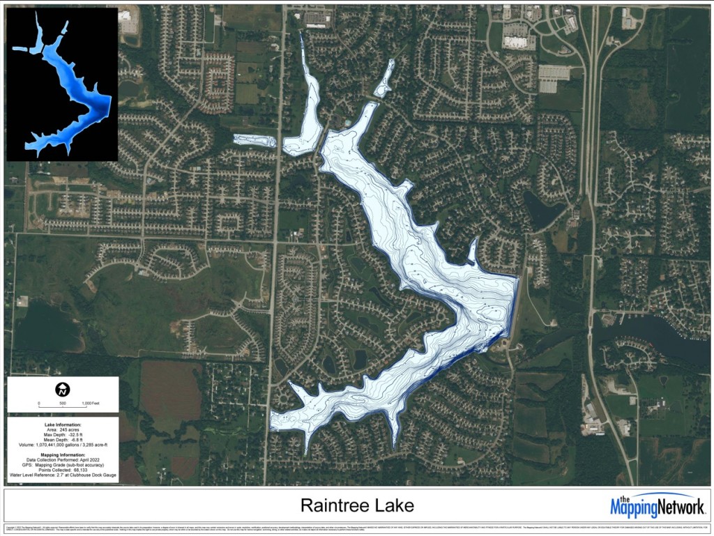
This information was provided by The Mapping Network
The health of our lake equals the health of our community
• Water has a healing quality and living in a lake community brings joy to our lives.
• Whether it is a daily stroll along the shore, participating in watersports or paddling around in a kayak.
• Besides the joy we gather from being surrounded by the lake it is also a major contributor to our property value.
Our lakes health is the most important investment we can make as a community.
• Without a healthy lake both our enjoyment and property values suffer.
• We only need to look to Hidden Cove to see the challenges of a silted in body of water
The additional challenge with Hidden Cove type vegetation is that when we have water events like we did leading into July 4th, all that vegetation ends up in the main lake and often takes hold there. Siltation is a natural process for all lakes
• Fast moving water carrying sediment moves into a slow pool and the sediment is dropped creating silt
• Eventually without action over time, lakes fill in and become marshes
Our lake is set up for success by the way much of the fast-moving water enters the main lake after traveling through silt pond buffers like Hidden Cove, Sunset Cove and Raintree Reserve.
Our Goal is to keep the capacity of the silt barrier ponds available so the main lake can stay healthy.